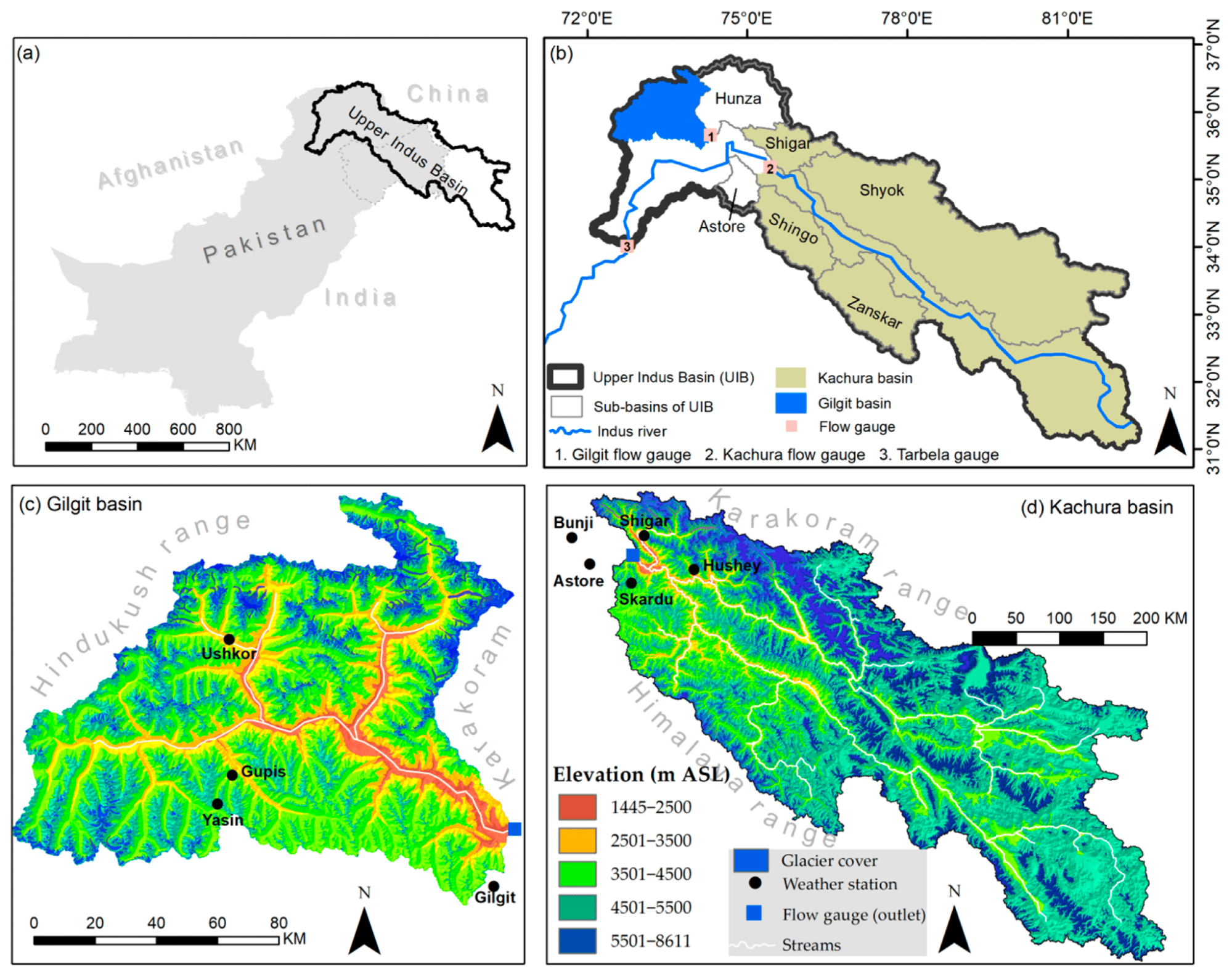
GlacioVision is an intelligent framework to forecast glacier retreat and evaluate its impact on water resources. Pakistan’s glaciers, particularly in the Karakoram and Hindu Kush, serve as vast natural reservoirs that feed the Indus River system and sustain agriculture, hydropower, and drinking water supplies for millions. But rising temperatures and erratic weather patterns are rapidly destabilizing these fragile ice bodies, leading to increased flood risks, seasonal water variability, and long-term freshwater shortages. GlacioVision tackles this challenge by combining multi-year satellite imagery with climate and meteorological data to model how glaciers evolve over time, offering both scientific insights and practical tools for water and disaster management.
At the heart of the project is a deep learning model designed to jointly predict glacier extent and surface elevation. Unlike traditional methods that treat these aspects separately, GlacioVision integrates Sentinel-1 radar imagery, Sentinel-2 optical data, ICESat-2 elevation points, and reanalysis climate variables into a single predictive system. The model leverages convolutional neural networks to extract spatial patterns, long short-term memory modules to capture temporal dynamics, and multilayer perceptrons to embed atmospheric influences. This multimodal, temporally-aware design allows the framework to generate high-resolution predictions of glacier masks and digital elevation models (DEMs), producing a comprehensive view of both surface retreat and volumetric changes. By learning from historical sequences of glacier behavior, the system can forecast near-future changes, providing a critical early warning mechanism for water security planning and climate adaptation.
GlacioVision’s predictive outputs can support government agencies in designing resilient water infrastructure, help disaster managers anticipate glacial lake outburst floods in vulnerable valleys, and guide farmers and hydropower operators in adapting to shifting river flows. The framework’s reliance on open satellite and climate datasets makes it scalable and replicable in other glacier-dependent regions of the world. In Pakistan, however, the project holds especially urgent significance because it provides an accessible way to understand glacier decline.