In this project, we use YOLOv8 to transform raw video feeds into actionable insights about traffic volumes. Traditional traffic monitoring systems often rely on static sensors (loop detectors or radar) that can miss dynamic patterns or require extensive infrastructure. This project takes advantage of affordable camera setups and deep learning to detect vehicles with precision and count them live in defined areas of interest. By fine-tuning a YOLOv8 model on a custom vehicle dataset, the system not only identifies vehicles but translates their movements into density maps. These maps can show congestion hotspots and temporal flow changes, providing real-time situational awareness to traffic engineers, urban planners, or smart city systems.
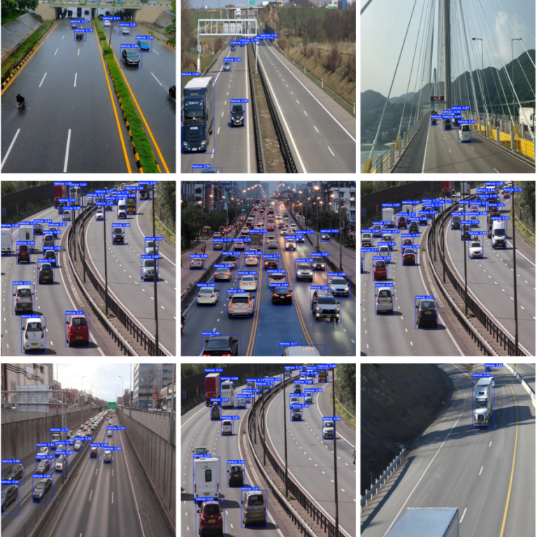
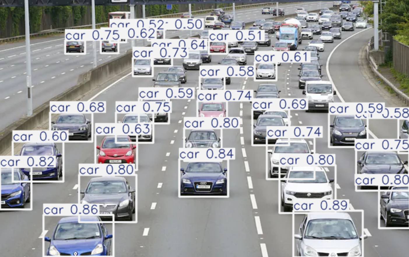
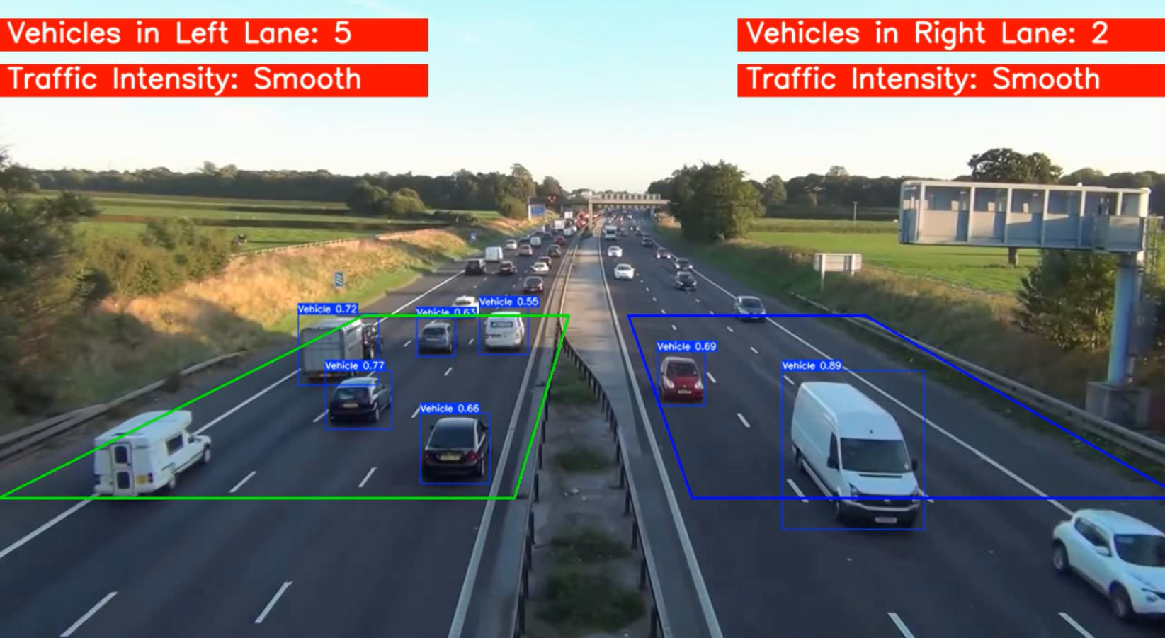
This work goes through loading a pre-trained YOLOv8n model, fine-tuning it with custom images and annotations, and then deploying it on a sample video. YOLOv8’s architecture allows for fast, high-accuracy detections even on edge devices, thanks to its efficient backbone and inference pipeline. Once vehicles are detected in each frame, their positions are tallied within predefined regions (such as lanes or junction zones) and translated into vehicle density statistics. The accompanying sample video and resulting traffic density analysis images demonstrate how the system highlights dense traffic clusters and tracks peaks over time. Performance metrics like training loss curves and confusion matrices ensure users can assess model accuracy and fine-tune further as needed. This modular architecture means you can swap in different datasets or expand the system to track vehicle types or multi-camera feeds.
The real magic of this system lies in its practicality and adaptability. It is a demonstration of how vision-based AI can make traffic insights more accessible, scalable, and responsive. By offering a full pipeline, from dataset preparation (image folders, YAML configs) to training scripts, model outputs, and inference demos, this work empowers analysts, developers, and city teams to deploy end-to-end traffic monitoring with minimal setup. From congested intersections to dynamic toll plazas or even parking lots, this solution scales from single-lane monitoring to complex multi-camera networks. Licensed under MIT and well-documented, it invites collaboration and extension, perhaps integrating historical density trends, alerting systems, or traffic signal optimization modules. In an age of urban mobility challenges, this project stands out as a ready-to-use blueprint for smarter, data-driven traffic management.